When dark clouds gather, knowing what to expect can help you stay safe. Here are six cloud types that indicate severe storms.
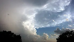
1. Cumulonimbus Clouds – The Storm Builders ⛈️🌩️
📍 Description: Towering clouds reaching up to 40,000 feet
📍 Appearance: Anvil-shaped tops, thick and dark
📍 Meaning: Expect heavy rain, hail, high winds, and possible tornadoes
⏳ What to Do: Stay updated on weather alerts and prepare for a potential storm.

2. Shelf Cloud – A Sign of Strong Winds 🌪️💨
📍 Description: Wedge-shaped clouds along the leading edge of storms
📍 Appearance: Dark, low, and rolling
📍 Meaning: Signals strong wind gusts, but not necessarily tornadoes
⏳ What to Do: Head inside until the winds pass.
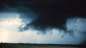
3. Wall Cloud – Tornado Warning! 🌪️🚨
📍 Description: Lowered clouds attached to a storm’s base
📍 Appearance: Flat, rotating, sometimes funnel-shaped
📍 Meaning: A tornado could form at any moment
⏳ What to Do: Take shelter immediately and follow tornado safety plans.
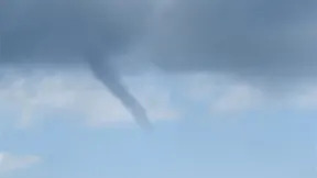
4. Funnel Cloud – A Tornado in the Making 🌪️⚠️
📍 Description: Narrow, funnel-shaped clouds extending downward
📍 Appearance: Can be thin or thick, but doesn’t touch the ground
📍 Meaning: If it touches down, it becomes a tornado
⏳ What to Do: Seek shelter and watch for warnings.
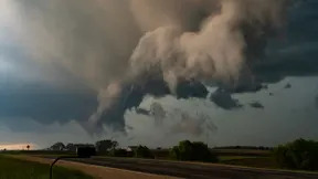
5. Scud Cloud – Looks Scary, But Harmless ☁️✅
📍 Description: Detached, ragged clouds under a storm
📍 Appearance: Fast-moving, chaotic
📍 Meaning: Usually harmless, but indicates a nearby storm
⏳ What to Do: Stay aware of changing weather.

6. Mammatus Clouds – A Sign of Severe Weather ☁️💥
📍 Description: Puffy, pouch-like clouds hanging from a storm
📍 Appearance: Cotton-ball clusters
📍 Meaning: A sign that a storm is strong but may be weakening
⏳ What to Do: Stay cautious, as strong winds or hail may still follow.
Final Thoughts
🌪️ Knowing these cloud types can help you prepare for severe weather.
☔ Which type of cloud have you seen before?
Leave a Reply